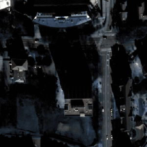
Datasets // Atlanta
SpaceNet AOI 6 – Atlanta
Catalog ID: Off-Nadir Building Detection
Image Time: 2009-12-22
SpaceNet Simple Storage Service (S3) Directory Structure (AOI 6)
AOIs
├── AOI_6_Atlanta
│   │
│   ├── nadir7_catid_1030010003D22F00                          # Raw source geotiffs for collect 1030010003D22F00
│   │   │
│   │   ├── MS                                                 # Raw source geotiffs of 8-Band Multi-Spectral raster data from WorldView-2
│   │   ├── PAN                                                # Raw source geotiffs of Panchromatic raster data from Worldview-2
│   │   └── PS-RGBNIR                                          # Raw source geotiffs of RGB+NIR raster data from Worldview-2 pansharpened to 0.5m
│   │
│   ├── nadir8_catid_10300100023BC100                          # Raw source geotiffs (divided as shown in the nadir7 collect) for collect 10300100023BC100
│   ├── nadir10_catid_1030010003993E00                         # Raw source geotiffs (divided as shown in the nadir7 collect) for collect 1030010003993E00
│   ├── nadir10_catid_1030010003CAF100                         # Raw source geotiffs (divided as shown in the nadir7 collect) for collect 1030010003CAF100
│   ├── nadir13_catid_1030010002B7D800                         # Raw source geotiffs (divided as shown in the nadir7 collect) for collect 1030010002B7D800
│   ├── nadir14_catid_10300100039AB000                         # Raw source geotiffs (divided as shown in the nadir7 collect) for collect 10300100039AB000
│   ├── nadir16_catid_1030010002649200                         # Raw source geotiffs (divided as shown in the nadir7 collect) for collect 1030010002649200
│   ├── nadir19_catid_1030010003C92000                         # Raw source geotiffs (divided as shown in the nadir7 collect) for collect 1030010003C92000
│   ├── nadir21_catid_1030010003127500                         # Raw source geotiffs (divided as shown in the nadir7 collect) for collect 1030010003127500
│   ├── nadir23_catid_103001000352C200                         # Raw source geotiffs (divided as shown in the nadir7 collect) for collect 103001000352C200
│   ├── nadir25_catid_103001000307D800                         # Raw source geotiffs (divided as shown in the nadir7 collect) for collect 103001000307D800
│   ├── nadir27_catid_1030010003472200                         # Raw source geotiffs (divided as shown in the nadir7 collect) for collect 1030010003472200
│   ├── nadir29_catid_1030010003315300                         # Raw source geotiffs (divided as shown in the nadir7 collect) for collect 1030010003315300
│   ├── nadir30_catid_10300100036D5200                         # Raw source geotiffs (divided as shown in the nadir7 collect) for collect 10300100036D5200
│   ├── nadir32_catid_103001000392F600                         # Raw source geotiffs (divided as shown in the nadir7 collect) for collect 103001000392F600
│   ├── nadir34_catid_1030010003697400                         # Raw source geotiffs (divided as shown in the nadir7 collect) for collect 1030010003697400
│   ├── nadir36_catid_1030010003895500                         # Raw source geotiffs (divided as shown in the nadir7 collect) for collect 1030010003895500
│   ├── nadir39_catid_1030010003832800                         # Raw source geotiffs (divided as shown in the nadir7 collect) for collect 1030010003832800
│   ├── nadir42_catid_10300100035D1B00                         # Raw source geotiffs (divided as shown in the nadir7 collect) for collect 10300100035D1B00
│   ├── nadir44_catid_1030010003CCD700                         # Raw source geotiffs (divided as shown in the nadir7 collect) for collect 1030010003CCD700
│   ├── nadir46_catid_1030010003713C00                         # Raw source geotiffs (divided as shown in the nadir7 collect) for collect 1030010003713C00
│   ├── nadir47_catid_10300100033C5200                         # Raw source geotiffs (divided as shown in the nadir7 collect) for collect 10300100033C5200
│   ├── nadir49_catid_1030010003492700                         # Raw source geotiffs (divided as shown in the nadir7 collect) for collect 1030010003492700
│   ├── nadir50_catid_10300100039E6200                         # Raw source geotiffs (divided as shown in the nadir7 collect) for collect 10300100039E6200
│   ├── nadir52_catid_1030010003BDDC00                         # Raw source geotiffs (divided as shown in the nadir7 collect) for collect 1030010003BDDC00
│   ├── nadir53_catid_1030010003193D00                         # Raw source geotiffs (divided as shown in the nadir7 collect) for collect 1030010003193D00
│   ├── nadir53_catid_1030010003CD4300                         # Raw source geotiffs (divided as shown in the nadir7 collect) for collect 1030010003CD4300
│   │
│   └── metadata                                               # Collection metadata for the above collects
│
spacenet
└── SN4_buildings
    │
    ├── tarballs
    │   │
    │   ├── train
    │   │   │
    │   │   ├── Atlanta_nadir7_catid_1030010003D22F00.tar.gz   # Tiled source geotiffs for collect
    │   │   ├── Atlanta_nadir8_catid_10300100023BC100.tar.gz
    │   │   ├── Atlanta_nadir10_catid_1030010003993E00.tar.gz
    │   │   ├── [etc.]
    │   │   └── geojson.tar.gz                                 # Building footprint label geojsons for the training dataset
    │   │
    │   ├── SpaceNet-Off-Nadir_Test_Public.tar.gz              # Public test imagery from all 27 collects
    │   └── SpaceNet-Off-Nadir_Sample.tar.gz                   # Sample imagery and labels for the SpaceNet 4: Off-nadir building footprint extraction challenge
    │
    ├── train                                                  # Tiled training imagery and building footprint labels
    │   │
    │   └── AOI_6_Atlanta
    │       │
    │       ├── nadir7_catid_1030010003D22F00                  # Tiled geotiffs for collect 1030010003D22F00
    │       │   │
    │       │   ├── MS                                         # Tiled geotiffs of 8-Band Multi-Spectral raster data from WorldView-2
    │       │   ├── PAN                                        # Tiled geotiffs of Panchromatic raster data from Worldview-2
    │       │   └── PS-RGBNIR                                  # Tiled geotiffs of RGB+NIR raster data from Worldview-2 pansharpened to 0.5m
    │       │
    │       ├── nadir8_catid_10300100023BC100
    │       ├── nadir10_catid_1030010003993E00
    │       ├── nadir10_catid_1030010003CAF100
    │       ├── nadir13_catid_1030010002B7D800
    │       ├── [etc.]
    │       └── geojson_buildings                              # Tiled building footprint label geojsons for the training dataset
    │
    └── test_public                                            # Tiled public test set images and building footprint labels
        │
        └── AOI_6_Atlanta # Public test imagery from all 27 collects
            ├── nadir7_catid_1030010003D22F00                  # Tiled public test set geotiffs for collect 1030010003D22F00
            │   │
            │   ├── MS                                         # Tiled public test set geotiffs of 8-Band Multi-Spectral raster data from WorldView-2
            │   ├── PAN                                        # Tiled public test set geotiffs of Panchromatic raster data from Worldview-2
            │   └── PS-RGBNIR                                  # Tiled public test set geotiffs of RGB+NIR raster data from Worldview-2 pansharpened to 0.5m
            │
            ├── nadir8_catid_10300100023BC100
            ├── nadir10_catid_1030010003993E00
            ├── nadir10_catid_1030010003CAF100
            ├── nadir13_catid_1030010002B7D800
            └── [etc.]
Atlanta // Buildings Dataset Resources
AOI 6 – Atlanta – Building Footprint Extraction Training
The path to the processed 450mx450m tiles of AOI 6 with associated building footprint labels for training is:
s3://spacenet-dataset/spacenet/SN4_buildings/tarballs/train/