SN8: Flood Detection Challenge Using Multiclass Segmentation
The Problem
Each year, natural disasters such as hurricanes, tornadoes, earthquakes and floods significantly damage infrastructure and result in loss of life, property and billions of dollars. As these events become more frequent and severe, there is an increasing need to rapidly develop maps and analyze the scale of destruction to better direct resources and first responders.
To help address this need, the SpaceNet 8 Flood Detection Challenge will focus on infrastructure and flood mapping related to hurricanes and heavy rains that cause route obstructions and significant damage. The goal of SpaceNet 8 is to leverage the existing repository of datasets and algorithms from SpaceNet Challenges 1-7 and apply them to a real-world disaster response scenario, expanding to multiclass feature extraction and characterization.
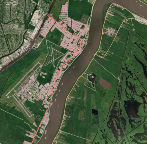
Since its launch in 2016, SpaceNet has made significant progress advancing open-source building footprint and road extraction algorithms. During SpaceNet 8, challenge participants will train algorithms on imagery and labels from previous challenges—as well as newly created labeled training datasets from Maxar—to rapidly map an area affected by flooding. Any winning open-source algorithm from SpaceNet 1-7 may also be used. New areas of interest (AOIs) will include New Orleans, Louisiana, following Hurricane Ida in August 2021; Dernau, Germany, during the June 2021 floods across Western Europe; and a new “mystery city” for blind testing of the algorithms.
SpaceNet 8 aims to answer these questions:
- How have algorithms that extract buildings and roads improved since SpaceNet was launched, and how can top algorithms from previous challenges be leveraged?
- What is the impact on performance for a multiclass feature extraction challenge—i.e., buildings and roads?
- How accurately can roads obstructed by flood waters be characterized from pre-event road detections and post-event satellite imagery?
Training Data
aws s3 cp s3://spacenet-dataset/spacenet/SN8_floods/tarballs/Germany_Training_Public.tar.gz . aws s3 cp s3://spacenet-dataset/spacenet/SN8_floods/tarballs/Louisiana-East_Training_Public.tar.gz . Testing Data
aws s3 cp s3://spacenet-dataset/spacenet/SN8_floods/tarballs/Louisiana-West_Test_Public.tar.gz . Catalog
- The data is hosted on AWS as a Public Dataset. It is free to download. An AWS account is not required; however, you must have the AWS CLI installed to access the data.
- To explore the dataset:
aws s3 ls s3://spacenet-dataset/spacenet/SN8_floods/
License

The SpaceNet Dataset by SpaceNet Partners is licensed under a Creative Commons Attribution-ShareAlike 4.0 International License.