SN9: Cross-Modal Satellite Imagery Registration
The Problem
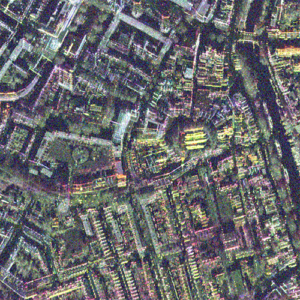
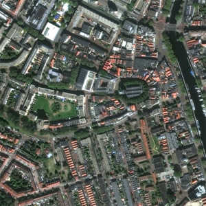
Swift and effective disaster response often relies on the integration and analysis of diverse remote sensing data sources such as electro-optical and Synthetic Aperture Radar (SAR). However, the co-registration of optical and SAR imagery remains a major challenge due to the inherent differences in their acquisition methods and data characteristics. SpaceNet 9 aimed to address this issue by focusing on cross-modal image registration, a critical preprocessing step for disaster analysis and recovery.
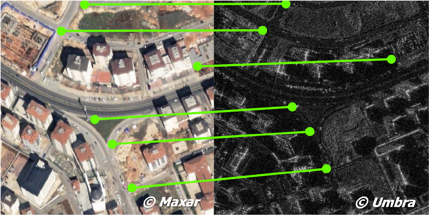
Participants in this challenge developed algorithms to compute pixel-wise spatial transformations between optical imagery and SAR imagery, specifically in earthquake-affected regions. These algorithms were evaluated for their ability to align tie-points across modalities, enabling better downstream analytics such as damage assessment and change detection.
To support the competition, the challenge provided a dataset consisting of high-resolution optical imagery from the Maxar Open Data Program and SAR imagery from UMBRA. The dataset includes manually labeled tie-points to evaluate registration quality. A baseline algorithm was also provided to set a performance benchmark, but participants are encouraged to explore novel approaches to significantly improve accuracy.
The objective of this challenge was to create algorithms that take two input images—an optical image and a SAR image—and output a two-channel transformation map. Each channel of the output image represents the shifts in the x and y directions required to align the optical image with the SAR image.
The accuracy of the output was evaluated using tie-points, which were manually identified matching features (e.g., road intersections) between the two images. The spatial transformation predicted by the algorithm was then applied to the tie-points in the optical image, and the alignment quality was assessed based on the distance between the transformed points and their corresponding reference points in the SAR image.
https://spacenet-dataset.s3.us-east-1.amazonaws.com/spacenet/SN9_cross-modal/train.zip https://spacenet-dataset.s3.us-east-1.amazonaws.com/spacenet/SN9_cross-modal/testpublic.zipLicense

The SpaceNet Dataset by SpaceNet Partners is licensed under a Creative Commons Attribution-ShareAlike 4.0 International License.
 Determining optimal routing paths in near real-time is at the heart of many humanitarian, civil, military, and commercial challenges. This statement is as true today as it was two years ago when the SpaceNet Partners announced the
  Can you help us automate mapping from off-nadir imagery? In this challenge, competitors were tasked with finding automated methods for extracting map-ready building footprints from high-resolution satellite imagery from high off-nadir imagery. In many disaster scenarios the first post-event imagery is from a more off-nadir image than is used in standard mapping use cases. The ability to use higher off-nadir imagery will allow for more flexibility in acquiring and using satellite imagery after a disaster. Moving towards more accurate fully automated extraction of building footprints will help bring innovation to computer vision methodologies applied to high-resolution satellite imagery, and ultimately help create better maps where they are needed most.